 Signalized Intersection
 Un-Signalized Intersection
DATA SUMMARY
INT
Intersection
WKD
Week Day
WKND
Week End
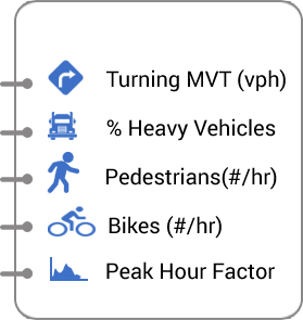
Turning Movements
% of Heavy Vehicles
Bikes
Pedestrians
Peak Hour Factor
DWN
Download Traffic Count Files
Bulk DWN
Summarized Traffic Data
2012 Turning Movements Heat Map

LEGEND
Intersection Information
- Intersection ID: 3080
- Intersection type: signalized
- Major Street: Pacific Ave
- Minor Street: S 64th St
AM Peak Hour Intersection Turning Movements
- 1250
- 59
- 1103
- 88


- 39

- 81
- 153

- 33
- 49

- 213
- 117

- 47


- 31
- 597
- 52
- 680
PM Counts Period: Any Hour between 3 PM to 7 PM
Traffic Volumes variation at EB
 North
North